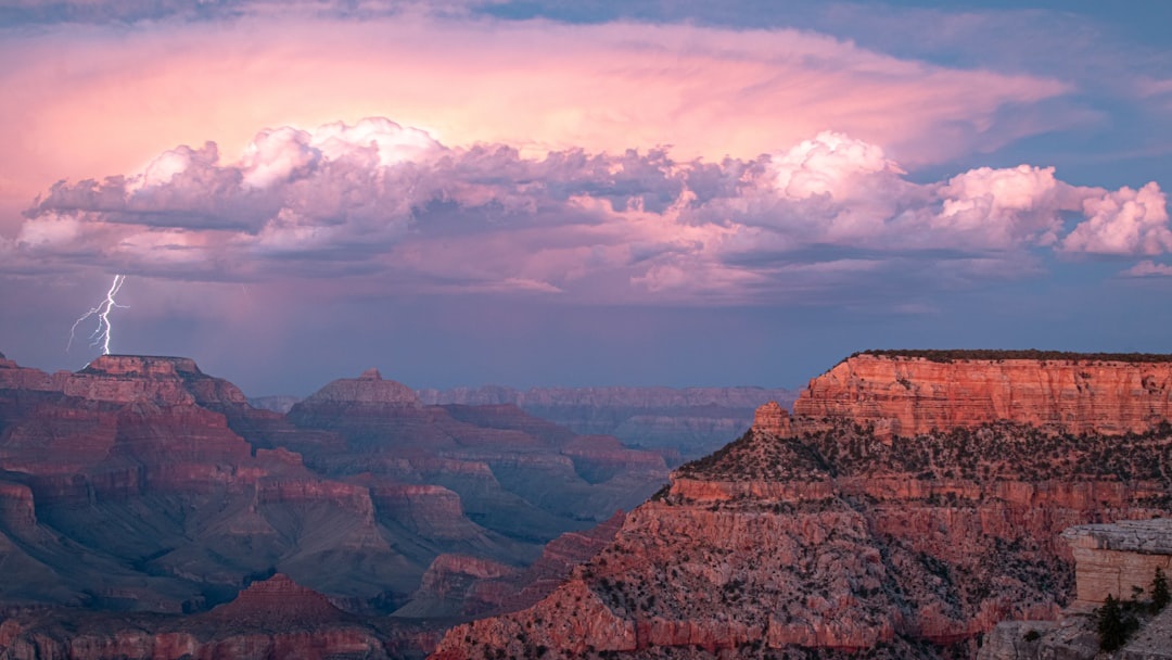
September is one of the smartest months to visit the Grand Canyon: cooler rims, thinner crowds, and golden shoulder-season light. It is also still flash-flood season, especially after monsoon storms roll across northern Arizona in the afternoon and dump rain miles away from the trail you’re standing on.
Key Takeaways
- Grand Canyon entry costs $35 per vehicle for 7 days, but closures from flooding can change trail access with little notice.
- Flash-flood risk is highest in narrow canyons, washes, creek crossings, and below rim trails, especially from about 1–6 p.m.
- Download the NPS App, MyRadar, and offline Google Maps before arrival because cell service is patchy below the rim.
- South Rim is the safest base for most visitors: Tusayan is 7 miles/15 minutes away, while Flagstaff is about 80 miles/1.5 hours.
- Skip long inner-canyon hikes after storm warnings; do rim viewpoints or short South Kaibab hikes instead.
Why Flash Flooding Matters at the Grand Canyon in September
Flash floods at the Grand Canyon are not just “heavy rain.” They are fast-moving walls of water, mud, rocks, and debris that can surge through dry-looking washes and side canyons within minutes.
September sits at the tail end of Arizona’s monsoon season, which usually runs from mid-June through September. The South Rim may be sunny at 10 a.m., then a thunderstorm can drop rain 10 miles away and send water through a drainage you never saw coming.
The key comparison: rim walks are exposed to lightning and hail, but inner-canyon routes add flood channels, rockfall, and limited escape options. A 2-mile rim walk near Mather Point is much easier to abandon than a 9.5-mile descent to the Colorado River on Bright Angel Trail.
| Area | Flood Risk | Best September Strategy |
|---|---|---|
| South Rim viewpoints | Low flood risk, higher lightning exposure | Go early, retreat indoors during storms |
| Bright Angel Trail | Moderate to high below the rim | Turn around before storms build after lunch |
| North Kaibab Trail | High near creek corridors | Avoid if flood watches are posted |
| Havasu Falls / Havasu Creek | Very high during storm events | Check official tribal and permit updates before driving |
Grand Canyon National Park posts alerts at nps.gov/grca. Check that page before leaving your hotel, not once you reach the trailhead, because service can disappear quickly below the rim.
Where Flash Flooding Is Most Dangerous: Skip These Routes After Storm Warnings
The most dangerous places are not always the most dramatic-looking. Dry washes, narrow side canyons, and creekside trails can become traps because water may arrive from a storm you cannot see.
Skip deep inner-canyon hikes if the National Weather Service posts a flash flood watch or warning. Do the Trail of Time instead: it’s a paved 2.8-mile rim walk between Yavapai Geology Museum and Verkamp’s Visitor Center, with big views and easy exit points.
Trails and areas to treat seriously
- Bright Angel Trail: Havasupai Gardens is 4.5 miles one-way and about 3,000 feet below the rim; that is not a casual “beat the storm” hike.
- South Kaibab Trail: Ooh Aah Point is 0.9 miles one-way, Cedar Ridge is 1.5 miles one-way, and there is no water on the trail.
- North Kaibab Trail: Roaring Springs is 4.7 miles one-way from the North Rim, with creek corridors and fewer nearby services.
- Hermit Trail and Grandview Trail: steeper, rougher, and less forgiving than the corridor trails after rain.
- Havasu Creek: beautiful, but flooding can close access and strand visitors; always check Havasupai Tribe updates before travel.
My opinionated rule: if the forecast shows thunderstorms, skip Bright Angel to Havasupai Gardens and do South Kaibab to Ooh Aah Point at sunrise instead. That is roughly 1.8 miles round-trip versus 9 miles round-trip, and you will be back before the afternoon storm machine wakes up.
For context, South Rim sits around 7,000 feet elevation and can feel mild in September, often in the 60s–70s°F during the day. The inner canyon can still push 95–105°F early in the month, which means heat risk and flood risk can exist on the same hike.
How to Check Flood Risk Before You Hike
Do not rely on blue sky. At the Grand Canyon, the question is not only “Is it raining here?” but “Is it raining upstream?”
Start with the National Park Service alerts page, then cross-check the National Weather Service Flagstaff office. The NWS is faster for watches and warnings, while the NPS is better for trail closures, shuttle changes, and road impacts.
| Tool | Cost | Best Use | Offline? |
|---|---|---|---|
| NPS App | Free | Park maps, alerts, basic trail info | Yes, if downloaded |
| MyRadar | Free; Pro from about $9.99/year | Storm cells and rain movement | No |
| Gaia GPS | Free; Premium about $59.90/year | Offline topo maps and routes | Yes with Premium |
| Google Maps Offline | Free | Driving to Tusayan, Flagstaff, viewpoints | Yes |
Download maps in Flagstaff, Williams, or your hotel Wi‑Fi before entering the park. Verizon and AT&T can work around Grand Canyon Village, but below the rim you should assume zero reliable data.
Tech tip from too many trail mistakes: enable Wireless Emergency Alerts on your phone and keep it out of battery-saver mode during stormy afternoons. A 10,000 mAh power bank costs about $20–$35 on Amazon and is more useful here than a fancy camera lens.
What to Do If a Flash Flood Warning Hits While You’re in the Park
If a warning hits, do not “wait and see” in a wash, slot, creek bed, or below a pour-off. Move to higher ground immediately, even if the water is not visible yet.
One foot of fast-moving water can knock a person down; two feet can move some vehicles. In canyon terrain, depth is not the only problem — debris, boulders, and mud are often moving with it.
- Leave low ground: climb to a bench, slope, or established trail above the drainage.
- Do not cross flowing water: wait it out or turn back; a delayed itinerary is cheaper than a rescue.
- Avoid cliff edges: rain loosens rock and makes limestone and sandstone slick.
- Call 911 if someone is in danger: give trail name, nearest landmark, and GPS coordinates if available.
- Follow ranger instructions: closures are not suggestions, and citations can cost more than your park pass.
Compare the choices: waiting 60–90 minutes for a storm cell to pass costs you a dinner reservation; pushing across a flooded wash can trigger a rescue that may take hours. Search-and-rescue response in the canyon is complicated by weather, daylight, and helicopter availability.
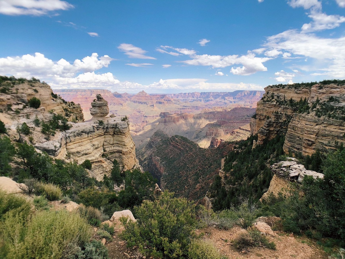
If you are driving, never cross flooded roads on Desert View Drive, Hermit Road access points, or side roads outside the park. Turn around and check Arizona road conditions at AZ511.gov.
Best Safer Alternatives When Storms Are in the Forecast
Stormy forecast does not mean your Grand Canyon day is ruined. It means you should choose routes with quick exits, shuttle access, and indoor options nearby.
Skip “rim-to-river and back” day hikes unless you are highly experienced, properly equipped, and starting before sunrise with a clean forecast. Do rim-based viewpoints, short trails, museums, and lodge meals instead.
Smart storm-day swaps
- Instead of Bright Angel to Plateau Point: walk the Rim Trail from Grand Canyon Village to Yavapai Point, about 1.5 miles one-way.
- Instead of South Kaibab to Skeleton Point: hike to Ooh Aah Point, 0.9 miles one-way, then turn around.
- Instead of Hermit Trail: ride the Hermits Rest shuttle and hop off at Maricopa Point, Hopi Point, and Pima Point.
- Instead of driving to the North Rim: stay South Rim; South Rim to North Rim is about 212 miles and 4.5 hours by car.
The South Rim shuttle system is free with park entry. Hermit Road is usually shuttle-only from March through November, and buses typically start early morning and run until around sunset, though exact hours change by season.
Car versus shuttle is an easy call in September: shuttle is $0 and avoids parking stress, while driving between busy lots can cost 20–40 minutes of circling. Mather Point fills fast after 9 a.m.; Yavapai Point and Market Plaza are usually less painful.
Where to Stay If You Want Flexibility During Flood Season
Stay as close to the South Rim as your budget allows. When weather changes quickly, being 10 minutes from your room beats being 90 minutes away in Flagstaff.
Inside the park, book through Grand Canyon Lodges for El Tovar, Bright Angel Lodge, Maswik Lodge, and Kachina/Thunderbird. Yavapai Lodge is booked separately through Visit Grand Canyon.
| Base | Distance to South Rim | Typical September Rate | Best For |
|---|---|---|---|
| Grand Canyon Village | 0–2 miles | $180–$550/night | Fast weather pivots, sunrise access |
| Tusayan | 7 miles / 15 minutes | $170–$350/night | Families, last-minute rooms |
| Williams | 60 miles / 1 hour | $100–$220/night | Lower prices, Route 66 stopover |
| Flagstaff | 80 miles / 1.5 hours | $120–$260/night | Better restaurants, airport access |
My pick: Maswik Lodge if you want practicality over romance. El Tovar has history and views, but paying $400+ to sit through a storm is less appealing than paying around $220–$300 at Maswik and walking 10 minutes to the rim when skies clear.
If park lodging is sold out, search hotels in Flagstaff and choose a refundable rate. Flagstaff gives you better food, grocery stores, gear shops, and a realistic Plan B if the canyon gets hammered by storms.
For vacation rentals in Williams or Flagstaff, check the total price before you bite; cleaning fees can erase the nightly-rate advantage. Distratech has a useful breakdown of how Airbnb fee changes may affect your next stay, which is worth reading before booking a “$119” cabin that becomes $241 at checkout.
What to Pack for Flood-Aware Grand Canyon Travel
Your packing list should handle two extremes: hot inner-canyon sun and cold, wet rim storms. In September, that can happen on the same day.
A disposable poncho costs about $3–$6, but a real rain shell in the $80–$150 range is worth it if you plan to hike below the rim. Cotton hoodies get heavy and cold fast; skip them for trail use.
- 2–3 liters of water per person: more if hiking below the rim; a 3L hydration bladder costs about $25–$45.
- Electrolytes: Liquid I.V. or Nuun tablets cost about $0.70–$1.50 per serving.
- Rain shell: Patagonia Torrentshell or REI Rainier are solid; skip cheap plastic for long hikes.
- Offline maps: NPS App plus Gaia GPS or AllTrails downloaded before arrival.
- Headlamp: Black Diamond models run about $25–$60 and beat phone flashlights.
- Power bank: Anker 10,000 mAh units are usually $20–$35 and can recharge most phones 1.5–2 times.
- Traction-minded shoes: trail runners beat smooth sneakers on wet limestone.
Do not bring an umbrella as your main rain plan for exposed rim walks. Wind gusts along the edge can turn it useless in seconds, while a rain shell keeps both hands free.
Costs, Hours, and Booking Details You Should Know Before You Go
Grand Canyon National Park is open 24 hours a day, 365 days a year, but visitor centers, shuttles, restaurants, and road access vary by season and weather. Always verify same-day hours on the NPS site or at the lodge front desk.
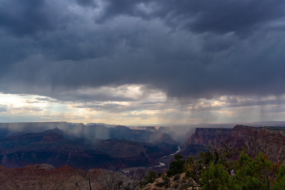
Entry costs $35 per private vehicle, $30 per motorcycle, or $20 per person if arriving on foot, bike, or shuttle; passes are valid for 7 days. The America the Beautiful annual pass is $80 and pays off if you’ll visit three or more national parks in a year.
| Item | Cost | Book / Check | Flood-Season Note |
|---|---|---|---|
| Park entry | $35/vehicle | Entrance station or recreation.gov | No refunds for weather closures |
| Backcountry permit | $10 permit + $15/person/night | recreation.gov | Check drainage and campsite alerts |
| South Rim shuttle | Free | NPS shuttle page | Routes may change after storms |
| Grand Canyon Railway | From about $70 adult coach round-trip | thetrain.com | Good no-driving option from Williams |
| Guided day hike | About $120–$250/person | Local permitted outfitters | Ask cancellation policy for weather |
For food, skip the most crowded grab-and-go counters at noon and go earlier or later. I like Yavapai Tavern for a post-hike burger and local beer; expect about $17–$22 for a burger and $8–$10 for a pint, with typical hours around 11 a.m.–9 p.m.
El Tovar Dining Room is the classic splurge, but book ahead and expect entrées around $28–$48. If storms are likely, I would rather keep dinner flexible at Maswik Food Court, where a filling meal is usually $14–$20 and you are not racing a reservation after a shuttle delay.
September Timing: When to Hike, Drive, and Recheck the Forecast
In September, the best hiking window is usually sunrise to late morning. Start South Kaibab or Bright Angel around 5:45–6:30 a.m., then be back near the rim before early afternoon clouds build.
Shoulder season is real here, but not magical. Weekdays are noticeably calmer than Fridays and Saturdays, and lodging can still spike because fall has become pricier than summer in some top U.S. outdoor destinations.
A practical comparison: a Tuesday night in Williams might be $115, while a Saturday inside Grand Canyon Village can top $350. If you want savings without adding too much drive time, Tusayan on a weekday is the sweet spot.
Do not make your only Grand Canyon day the day after arrival if you can avoid it. Build in two nights, because a 36-hour window gives you a backup sunrise if storms shut down your first afternoon.
Bottom Line: Take Flood Warnings Seriously, But Don’t Cancel Too Fast
September can be one of the best months to see the Grand Canyon, with warm days, cooler rims, and fewer peak-summer crowds. The trick is to plan like a flexible traveler, not like someone trying to force a bucket-list hike through bad weather.
Check NPS and NWS alerts every morning, hike early, avoid narrow drainages during storm risk, and keep your lodging close enough to pivot. If the forecast turns ugly, trade the big descent for rim walks, shuttle viewpoints, museums, and a good meal — the canyon will still deliver.
Planning a trip soon? Bookmark the NPS conditions page, download your offline maps today, and book refundable lodging so a flash-flood warning changes your itinerary, not your whole vacation.
Frequently Asked Questions
Is the Grand Canyon safe to visit during flash flood season?
Yes, if you stay flexible and avoid low-lying drainages, narrow canyons, and creek crossings during storm watches or warnings. South Rim viewpoints and paved rim trails are generally safer than inner-canyon routes, but lightning can still be dangerous.
When is flash flooding most likely at the Grand Canyon?
Flash flooding is most likely during Arizona’s monsoon season, typically mid-June through September. In September, storms often build in the afternoon, especially between about 1 p.m. and 6 p.m.
How much does it cost to enter Grand Canyon National Park?
Entry costs $35 per private vehicle, $30 per motorcycle, or $20 per person if entering by foot, bicycle, or shuttle. Passes are valid for 7 days, and the $80 America the Beautiful pass is worthwhile if you plan to visit multiple national parks.
What should I do if a flash flood warning is issued while hiking?
Move immediately to higher ground and do not cross flowing water. Call 911 if someone is in danger, give your trail name and location, and follow ranger instructions if trails or roads close.

About the Author: Tomáš Bzirský
Founder and editor of Distratech. Based in the Czech Republic, travelling regularly from Central Europe. Writes practical travel guides and travel-tech comparisons (eSIM, apps, airports) in six languages.