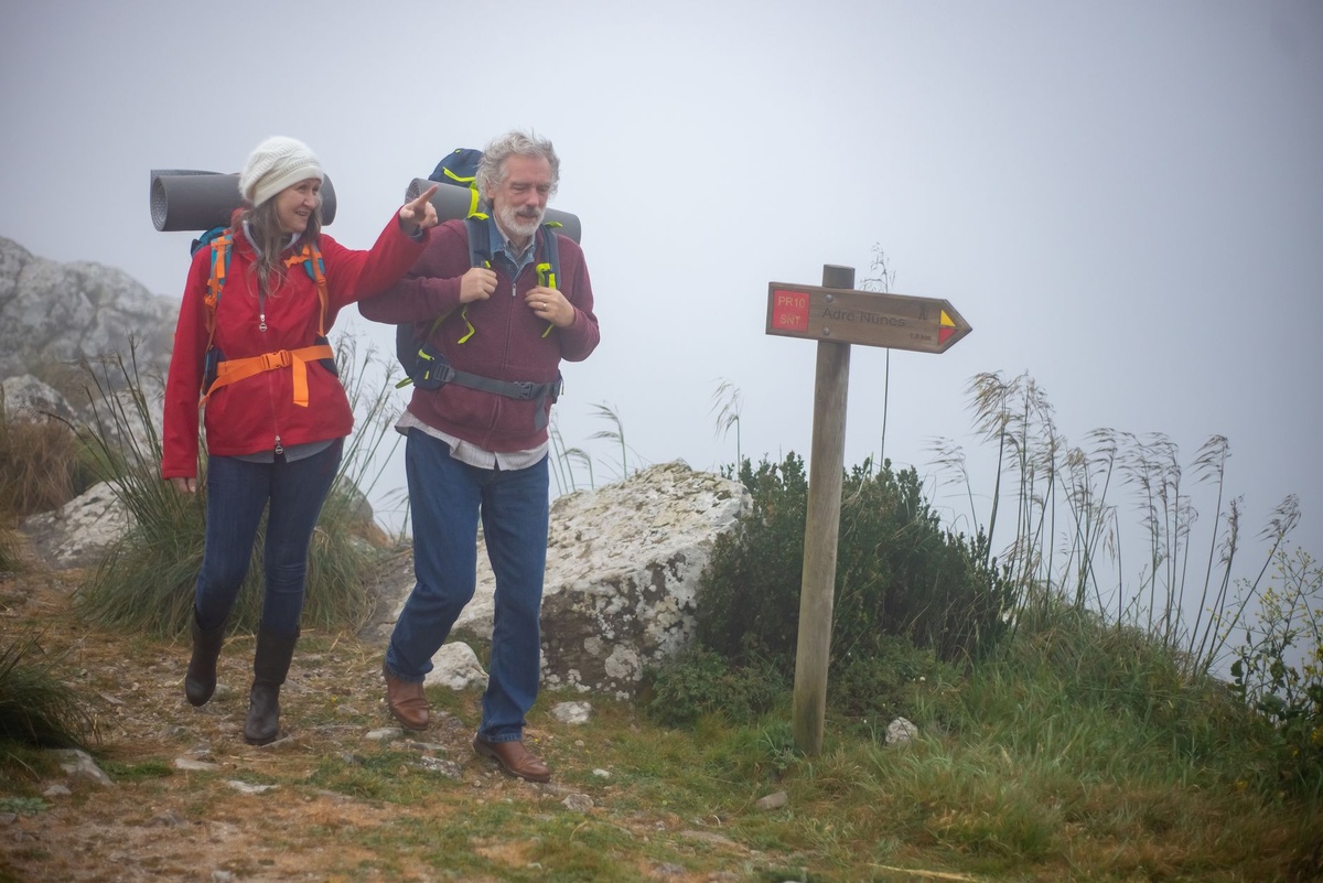
Hiking the Rota Vicentina in Portugal: A 5-Day Fishermen’s Trail Itinerary With GPX, Costs, and Wild Camping Rules
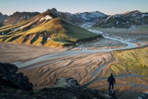
Portugal’s southwest coast in summer is wild in the best way: Atlantic cliffs exploding with wildflowers, storks nesting on sea stacks, and long golden beaches with more surfers than sunbeds. The Fishermen’s Trail (Trilho dos Pescadores), part of the Rota Vicentina, is the star — and June through September brings warm 70–85°F (21–30°C) days, ocean breezes, and late sunsets perfect for cliffside miles.
This is a practical, no-fluff 5-day itinerary from Porto Covo to Odeceixe with daily distances, GPX tips, real 2026 prices, and the current rules on wild camping (they’ve tightened). I hiked it in early June — here’s exactly how to plan it.
Key Takeaways
- Distance: ~75 km (46 miles) over 5 days from Porto Covo to Odeceixe.
- Budget: €40–€70/day camping; €80–€140/day staying in guesthouses.
- Wild camping is officially prohibited in the Southwest Alentejo Natural Park (fines €60–€600).
- Best months: May–June and September; July–August is hot and busy.
- Official GPX tracks available free at rotavicentina.com.
Overview: Why the Fishermen’s Trail (Not the Historical Way)
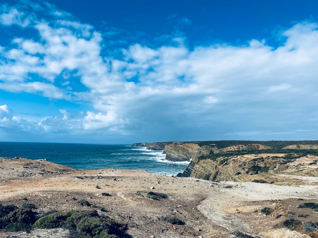
The Rota Vicentina has two main routes: the inland Historical Way and the coastal Fishermen’s Trail. If you’re here for drama — cliffs, sand, sea — skip the inland sections.
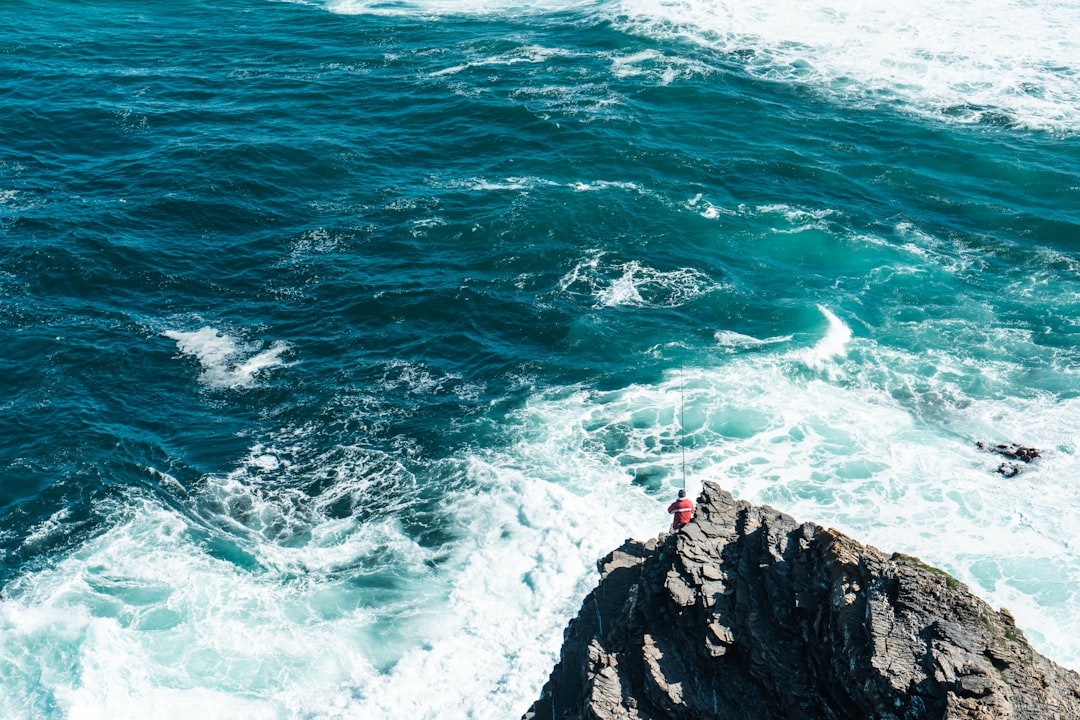
The Fishermen’s Trail sticks to the Atlantic edge. Expect soft sand (harder walking), narrow cliff paths, and constant ocean views. It’s more physically demanding than the Historical Way, despite similar daily distances.
Compared to Iceland’s Laugavegur (34 miles in 4 days, hut-based, permit-heavy), this trail is longer, cheaper, and logistically simpler — no river crossings, no mandatory huts. If you want that comparison, see our detailed guide to hiking the Laugavegur Trail in Iceland.
Day-by-Day: 5-Day Fishermen’s Trail Itinerary (North to South)
Day 1: Porto Covo → Vila Nova de Milfontes (20 km / 12.4 miles)
This is a big first day, but it sets the tone: sandy stretches, wooden boardwalks, turquoise coves. Start early — by 8am — to avoid mid-day heat.
Water refill points are limited after Ilha do Pessegueiro. Carry at least 2 liters in summer.
Stay: Camping Milfontes (€12–€15 per person, tent included extra €5). Guesthouse option: Casa do Adro (€95 double in June).
Dinner: Tasca do Celso — order the açorda de marisco (€18). Skip the touristy riverfront pizza spots.
Day 2: Vila Nova de Milfontes → Almograve (15 km / 9.3 miles)
Shorter and easier. You’ll cross the Mira River — small passenger boat taxi operates June–September, roughly €5 per person (cash). If it’s not running, inland detour adds ~6 km.
The sand sections before Almograve are deceptively tiring. Trekking poles help.
Stay: Camping Almograve (€10–€14). Guesthouse: Al Casa Paquito (€80–€110).
Eat: Restaurante O Lavrador — grilled dourada €16. Closed Mondays.
Day 3: Almograve → Zambujeira do Mar (22 km / 13.6 miles)
The longest and arguably most scenic day. Dramatic cliffs, almost lunar landscapes, and very little shade.
There’s one café in Cavaleiro roughly halfway. Espresso €1.20, sandwich €4–€6. Don’t count on more.
Stay: Camping Zambujeira (€12–€16). Guesthouse: Hakuna Matata Hostel (private room ~€70).
In August, Zambujeira hosts Festival do Sudoeste — accommodation prices double. Book weeks ahead.
Day 4: Zambujeira do Mar → Odeceixe (18 km / 11 miles)
Arguably the most beautiful stretch. The approach to Praia de Odeceixe is unforgettable — river on one side, Atlantic on the other.
Lots of sand. Budget extra time.
Stay: Camping São Miguel (8 km before Odeceixe, €10–€15) or Casas do Moinho in Odeceixe village (€120–€150 with pool).
Eat: Altinho in Odeceixe — sunset seafood rice €19. Reserve in summer.
Day 5: Odeceixe → Odeceixe Beach Loop or Rest Day (Optional 8–12 km)
Most people finish at Odeceixe. I recommend a short coastal loop toward Praia das Adegas for a relaxed final morning.
Bus back to Lisbon from Odeceixe: Rede Expressos, ~3.5 hours, €19–€23 if booked at rede-expressos.pt. Taxi to Lagos: ~€75, 1 hour 15 min.
GPX Files and Navigation (What Actually Works)
Download official GPX tracks free from rotavicentina.com. They’re accurate and updated.
I used:
- AllTrails+ (€35/year) for offline maps and elevation
- Maps.me (free) as backup
- Garmin Fenix watch for breadcrumb tracking
Cell service is surprisingly strong on cliff tops but drops in valleys. Don’t rely purely on Google Maps.
If you’re documenting the hike, weight matters. We compared the best travel cameras for carry-on only trips — honestly, for this trail, the iPhone 16 Pro is enough unless you’re shooting professionally.
Wild Camping Rules (Read This Before You Pitch a Tent)
The Fishermen’s Trail runs through the Southwest Alentejo and Vicentine Coast Natural Park. Wild camping is officially prohibited.
Fines range from €60 to €600. Enforcement increased in 2024–2026 due to overtourism and fire risk.
That said, some hikers still discreetly bivouac. If you’re considering it, know the risks.
Legal alternatives:
- Designated campgrounds every 10–20 km (€10–€16)
- Private gardens offering tent space via Booking.com (€15–€25)
- Hostels from €25 dorm / €70 private
Skip random Airbnb rooms booked via sketchy links — short-term rental scams are rising across Europe. If you’re unfamiliar with current tactics, read this breakdown on how Airbnb scams have surged in 2026 before sending deposits.
Cost Breakdown: What 5 Days Actually Cost (2026 Prices)
| Category | Budget (Camping) | Mid-Range (Guesthouses) |
|---|---|---|
| Accommodation (4 nights) | €50–€60 | €320–€480 |
| Food (groceries + 1 meal/day out) | €80–€110 | €120–€160 |
| Transport (Lisbon–Porto Covo + return) | €40–€50 | €40–€50 |
| Boat crossing Mira River | €5 | €5 |
| Total (5 days) | ~€175–€225 | ~€485–€695 |
Compared to the Camino Portuguese (~€30/day albergues) this is pricier, mainly due to fewer budget dorms.
When to Hike (Summer Reality Check)
June: Ideal. Wildflowers still blooming, 20–26°C (68–79°F), fewer crowds.
July–August: Hot (up to 32°C/90°F), busy, book accommodation 3–4 weeks ahead. Start hiking by 7am.
September: My favorite. Warm ocean, thinner crowds, golden light.
Fire risk can close sections temporarily in peak summer. Check updates at rotavicentina.com before starting.
Practical Tips I Wish I Knew
- Sand slows you down. Add 20% to your time estimates.
- Carry cash. Small cafés don’t always take cards.
- Sun protection is non-negotiable. There’s minimal shade.
- Water strategy: Fill up in every village — some 10–12 km stretches have no taps.
- North to south is easier. Prevailing winds are usually at your back.
Bus vs Taxi example: Lisbon to Porto Covo by bus takes ~3.5–4.5 hours with a transfer in Sines (€18–€25). Private transfer is ~2 hours 15 min but costs €180+. Unless you’re splitting 3–4 ways, take the bus.
Is the Fishermen’s Trail Worth It?
If you want alpine drama, go to the Dolomites. If you want cultural immersion, walk the Camino.
If you want five straight days of ocean cliffs, seafood dinners, salty wind, and relatively simple logistics — this is one of Europe’s best coastal hikes.
Plan smart, respect the park rules, book summer stays early, and download your GPX before arrival. Then just walk south with the Atlantic on your right.
Thinking of pairing it with Lisbon or Lagos? Check our other Portugal guides on Distratech — and if you’re heading out this summer, now’s the time to lock in buses and campsites.
Frequently Asked Questions
How much does it cost to hike the Fishermen’s Trail?
Camping and cooking some meals costs about €175–€225 for 5 days. Staying in guesthouses and eating out more runs €485–€695 total, excluding flights.
Is wild camping allowed on the Rota Vicentina?
No. The trail runs through a protected natural park where wild camping is prohibited, with fines from €60 to €600. Use official campgrounds (€10–€16) instead.
When is the best time to hike the Fishermen’s Trail?
May–June and September offer the best balance of good weather (20–26°C) and fewer crowds. July–August is hotter and requires advance booking.
Do I need a guide for the Fishermen’s Trail?
No. The route is well-marked and free GPX files are available on rotavicentina.com. Most hikers go self-guided using apps like AllTrails or Garmin.

About the Author: redactor
Travel writer and founder of Discover Travel (distratech.com) — a blog covering travel, food & drink, and technology. With 250+ articles spanning Europe, the Americas, Asia, and Africa, I help travelers discover alternative destinations, hidden gems, and budget-friendly tips backed by real experience and data. Whether it's the best street food in Bangkok, Easter celebrations across Europe, or scenic train routes — I write to inspire smarter, more authentic travel.