In Nepal’s high Himalaya, a flood can start without rain falling on your roof. A chunk of warming mountain—ice, rock, frozen debris—breaks loose, slams into a glacial lake, and sends a wall of water and boulders down-valley faster than most trekkers can run.
Key Takeaways
- September is prime Nepal trekking season, but late-monsoon slopes and glacial lakes can still be unstable.
- Everest-region permits cost about $38 total: $23 for Sagarmatha National Park plus $15 for the Khumbu local permit.
- Lukla flights take 30–35 minutes and cost roughly $180–$230 one-way, versus $15–$25 for a public jeep to Salleri plus 2–3 extra trekking days.
- Safer lodges sit above the river terrace; skip cheap riverside rooms after heavy rain or heat spikes.
- Use DHM Nepal, Windy, Maps.me/OsmAnd, and a satellite messenger if trekking beyond reliable mobile coverage.
The flood that tore through parts of Nepal’s Everest region shocked travelers because it happened in a place many people associate with postcard trekking: stone lodges, prayer flags, yak trails, and mountain views. But this is also a landscape being rapidly rewired by climate change.
This guide focuses on one angle: how ice-rock collapses can trigger Himalayan floods, and how to travel more intelligently in Nepal’s mountains in September 2026, when trekking season is opening, weather is improving, and risk is not zero.
What Actually Happened When the Mountain Fell
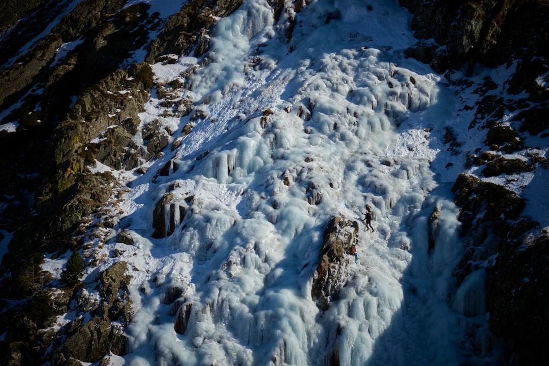
The dangerous chain reaction is brutally simple. A warming slope fails, ice and rock plunge into a glacial or moraine-dammed lake, the impact creates a surge wave, and the lake overtops or breaches its natural dam.
That sudden release becomes a glacial lake outburst flood, often shortened to GLOF. Unlike a normal river flood, a GLOF carries water, mud, house-sized boulders, bridge debris, and sometimes chunks of ice.
In Nepal’s Khumbu region, the village of Thame—about 9 km west of Namche Bazaar and roughly a 3–4 hour walk—became a warning sign for the entire trekking industry. Floodwater damaged homes, lodges, trails, and community buildings in a valley used by trekkers heading toward less-crowded Everest routes.
The timing matters. September is “shoulder season gold” across much of the travel world, but in Nepal it is also the transition from monsoon to trekking season. You get clearer skies than August, fewer crowds than October, and lower room pressure in Namche, but slopes can remain saturated and glacial lakes are still responding to summer heat.
| Flood type | Typical trigger | Warning time | Traveler risk |
|---|---|---|---|
| Monsoon river flood | Heavy rain over hours or days | Often several hours | Road closures, bridge washouts, flight delays |
| Glacial lake outburst flood | Ice/rock avalanche, moraine failure, rapid melt | Minutes to hours | Sudden valley-floor destruction, trail and lodge loss |
| Landslide-dammed flood | Rockslide blocks river, then dam bursts | Hours to days if detected | Downstream surge, road cutoffs |
For travelers, the practical difference is huge: a regular rain flood may give you time to change plans; an outburst flood may only give you time to get uphill.
Why Climate Change Is Raising the Risk in Nepal
The Himalaya is warming faster than the global average, and that matters because high mountains are held together by cold. When permafrost thaws, steep rock faces lose some of the frozen “glue” that stabilizes them.
Glaciers are also thinning and retreating, leaving behind lakes dammed by loose moraine. These natural dams are not engineered concrete walls; they are piles of rock, sediment, and ice that can fail under pressure.
ICIMOD has warned that glaciers in the Hindu Kush Himalaya could lose a major share of their volume this century if emissions remain high. A widely cited ICIMOD assessment found glacier mass loss accelerated sharply in the 2010s compared with the previous decade.
Nepal has thousands of glacial lakes, but not all are equally dangerous. Regional inventories have identified dozens of potentially dangerous glacial lakes across Nepal, Tibet/China, and India, with several sitting upstream of inhabited valleys, hydropower projects, trekking routes, and bridges.
Here is the uncomfortable travel truth: September’s improved visibility does not cancel out summer’s accumulated heat. A warm spell at 4,500–5,500 meters can destabilize ice even when Kathmandu café weather feels pleasant.
- Skip: assuming “no rain today” means “no flood risk today.”
- Do instead: ask your lodge owner about upstream lakes, recent bridge damage, and whether locals are avoiding any valley-floor trails.
- Skip: camping on dry riverbeds because they look flat and convenient.
- Do instead: camp or sleep at least 20–30 vertical meters above the active river channel when possible.
Data point for scale: the walk from Lukla to Namche is about 19 km spread over two trekking days, but the elevation gain from Lukla’s 2,860 m to Namche’s 3,440 m is enough to change weather, temperature, river behavior, and phone signal quality dramatically.
What This Means for Everest, Annapurna, and Manaslu Trekkers in September 2026
September is still one of the smartest months to trek in Nepal if you build in flexibility. Compared with peak October, tea houses are less packed, guides are easier to book, and Kathmandu–Lukla flights can be less chaotic, though weather delays remain common early in the month.
But travelers should stop treating Himalayan rivers as background scenery. In a warming mountain system, valley floors are the hazard zone.
For the Everest region, the standard route runs Lukla–Phakding–Namche–Tengboche–Dingboche–Lobuche–Gorak Shep. The flood-aware approach is not to cancel Everest Base Camp; it is to be pickier about where you sleep and how you move after hot days or heavy rain.
| Choice | Cost | Time | My take |
|---|---|---|---|
| Fly Kathmandu/Ramechhap to Lukla | $180–$230 one-way | 30–35 min flight, plus airport waiting | Fastest, but build in 1–2 buffer days |
| Public jeep to Salleri/Phaplu | $15–$25 | 8–10 hrs road + 2–3 trekking days | Cheaper and better acclimatization, rougher roads |
| Private jeep to Salleri | $250–$350 per vehicle | 8–10 hrs | Good for 4–6 people; avoid after heavy rain |
Permits are straightforward. For Everest, budget about NPR 3,000 ($23) for the Sagarmatha National Park permit and NPR 2,000 ($15) for the Khumbu Pasang Lhamu Rural Municipality permit.
The Nepal Tourism Board office at Bhrikutimandap in Kathmandu usually operates Sunday–Friday, around 10:00–17:00, closing on Saturdays and public holidays. For current rules, check Nepal Tourism Board and your trekking agency before paying anyone in cash.
Guide prices in 2026 are typically $30–$45 per day for a licensed trekking guide and $25–$35 per day for a porter, excluding tips. A “too cheap” $18 guide is a red flag; skip the bargain WhatsApp operator and book through a registered agency with a physical Kathmandu office.
Where to Stay: Choose Height Over River Views
In Nepal’s mountains, “river view” can be a liability. After the Thame flood, my rule is simple: if a lodge is on a low gravel bar beside a roaring river, skip it when there has been recent heavy rain, unusual warmth, or upstream damage reports.
In Kathmandu before your trek, stay in Thamel for gear access and agency meetings, but do not overpay for boutique minimalism if you need practical logistics. Compare hotels in Kathmandu; solid mid-range rooms usually run $35–$70 per night, while comfortable airport-area hotels cost $45–$90.
In Namche Bazaar, I like staying higher in the amphitheater rather than down by the river approach. Rooms in basic tea houses can be $5–$15 if you eat dinner and breakfast there, while upgraded lodges with attached bathrooms can hit $40–$90 per night in October but are often 10–20% easier to negotiate in September.
Food and extras add up faster than beds. Dal bhat may cost $6–$8 in Namche and $9–$12 higher up near Lobuche, compared with $2–$4 in Kathmandu.
| Item | Kathmandu | Namche/Everest trail | Better choice |
|---|---|---|---|
| Private room | $25–$70 | $5–$90 | Kathmandu for comfort, trail for simplicity |
| Dal bhat | $2–$4 | $6–$12 | Eat dal bhat on trail; it is refill-friendly |
| Hot shower | Included–$3 | $3–$7 | Skip daily showers above Namche |
| Device charging | Usually free | $2–$5 per hour/device | Carry a 20,000 mAh power bank |
For Kathmandu food, skip the bland rooftop “trekker menus” around central Thamel. Go to Yangling Tibetan Restaurant for momos under $4, Thamel Momo Hut for a fast pre-permit lunch around $3–$5, and Roadhouse Café when you need reliable pizza and Wi-Fi before a flight day.
The Tech Stack I’d Use for Flood-Aware Trekking
Your phone will not save you from a flood by itself, but the right setup helps you make better decisions before you enter a valley. Download maps and weather before leaving Kathmandu; do not rely on lodge Wi-Fi that costs $3–$8 and crawls when clouds roll in.
Install Windy for rainfall and freezing-level trends, Meteoblue for mountain forecasts, and Maps.me or OsmAnd for offline trail navigation. Add Nepal’s Department of Hydrology and Meteorology and the Nepal Disaster Risk Reduction Portal to your browser bookmarks.
For connectivity, buy an Ncell or Nepal Telecom SIM in Kathmandu; tourist SIM packs commonly cost $5–$12 depending on data. If your phone supports eSIM, Airalo is convenient for landing-day data, but I would still buy a local physical SIM for longer treks because mountain coverage varies by valley.
A Garmin inReach Mini 2 costs about $400, with plans from roughly $15 per month. That is expensive compared with a $10 SIM, but it works via satellite; for remote Manaslu side valleys or independent research travel, I would rent or carry one.
- Before flying: screenshot permits, insurance, lodge bookings, and emergency contacts.
- Before trekking: download offline maps for the full route plus exits to lower valleys.
- Daily: ask lodge owners about bridge status; local reports beat app forecasts.
- After heat or rain: avoid lingering beside rivers, especially at confluences and narrow gorges.
- If water suddenly turns muddy or drops fast: move uphill immediately; both can signal upstream blockage or release.
If you are connecting through Europe on the way to Nepal, build in more airport margin this autumn. Distratech’s guide to Europe’s changing EES border checks is worth reading if your itinerary includes a Schengen layover.
Insurance, Rescue, and the Cost of Getting It Wrong
Travel insurance for Nepal is not the place to save $40. Helicopter evacuation from the Khumbu can cost $4,000–$8,000, and complex rescues may exceed $10,000 if weather delays aircraft or multiple lifts are needed.
Buy a policy that explicitly covers trekking to your maximum altitude. Everest Base Camp is about 5,364 m, so a policy capped at 4,000 m is useless for the standard itinerary.
World Nomads-style adventure policies often price 14 days in Nepal around $90–$180 for many travelers, while premium rescue-inclusive plans can run $150–$300 depending on age, nationality, and altitude. Compare exclusions line by line; “hiking” and “mountaineering” are not the same in insurance language.
| Expense | Typical cost | Worth it? |
|---|---|---|
| Basic travel insurance without altitude cover | $40–$80 | No for EBC or high passes |
| Trekking policy to 5,500–6,000 m | $90–$250 | Yes, minimum sensible option |
| Satellite messenger rental/purchase | $10–$20/day rental or $400 purchase | Yes for remote routes, optional for busy EBC |
| Extra Kathmandu buffer day | $35–$90 hotel + food | Absolutely, cheaper than missed flights |
Skip itineraries that promise Everest Base Camp in 8–9 days unless you are flying out by helicopter. A safer standard itinerary is 12–14 days Kathmandu-to-Kathmandu, with at least two acclimatization days and one flight buffer day.
Should You Still Trek Nepal This September?
Yes—but with updated mountain literacy. September 2026 is still a strong month for Nepal: the trekking season is beginning, Himalayan visibility improves through the month, and trails are less crowded than the October rush.
The contrarian travel take that September is the best month for most destinations mostly holds here, with one caveat: early September behaves differently from late September. If you want lower flood and landslide disruption, choose late September into early October over the first week after intense monsoon rain.
For first-timers, Everest Base Camp and Annapurna remain reasonable with a licensed guide, buffer days, and conservative lodge choices. For independent trekkers chasing remote side valleys, the risk calculation is different: fewer people, fewer bridges, weaker phone coverage, and slower rescue.
My opinionated call: skip “secret” river-hugging shortcuts recommended by random YouTubers and do the boring official trail. In Nepal, boring often means maintained bridges, lodge networks, local eyes, and a better chance of hearing about upstream trouble before you walk into it.
Final Thoughts: Respect the New Himalaya
Nepal’s mountains are not becoming less beautiful. They are becoming less predictable.
When ice and rock fall into a glacial lake, the disaster downstream can look sudden, but the conditions were building for years: warmer air, thinning ice, unstable slopes, and expanding lakes above villages and trekking trails.
Go to Nepal this season if it is calling you. Just travel like the mountains are changing—because they are. Book flexible flights, hire qualified local support, sleep above river level, carry offline tools, and ask better questions every morning on the trail.
If this helped you plan smarter, save it before your trek and share it with the person in your group who always says, “We’ll figure it out when we get there.” In the Himalaya, figuring it out early is the whole point.
Frequently Asked Questions
What caused Nepal’s catastrophic mountain flood?
The likely chain was an ice-rock collapse into a high glacial lake, creating a surge that overtopped or breached the lake’s natural dam. The released water then rushed downstream with mud, boulders, and debris, which is typical of a glacial lake outburst flood.
Is September a safe time to trek in Nepal?
September is generally a good trekking month, especially later in the month, but early September can still carry monsoon-related landslide and flood risk. Build in 1–2 buffer days and avoid low river terraces after heavy rain or unusual warmth.
How much does an Everest Base Camp trek cost in 2026?
Budget travelers can manage around $35–$55 per day on the trail before flights, while guided packages often cost $1,200–$2,500. Add $360–$460 for round-trip Lukla flights, about $38 for Everest permits, and $90–$250 for proper trekking insurance.
Do I need a guide for trekking in Nepal?
For many Nepal trekking areas, guides are required or strongly recommended, and rules can vary by region. Expect to pay about $30–$45 per day for a licensed guide and $25–$35 per day for a porter.
What should I do if I hear a sudden roar or see muddy water rising?
Move uphill immediately and do not stop to film. A sudden roar, rapidly muddy water, or a fast river-level change can signal an upstream landslide, lake release, or debris flood.

About the Author: Tomáš Bzirský
Founder and editor of Distratech. Based in the Czech Republic, travelling regularly from Central Europe. Writes practical travel guides and travel-tech comparisons (eSIM, apps, airports) in six languages.