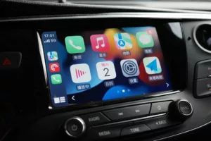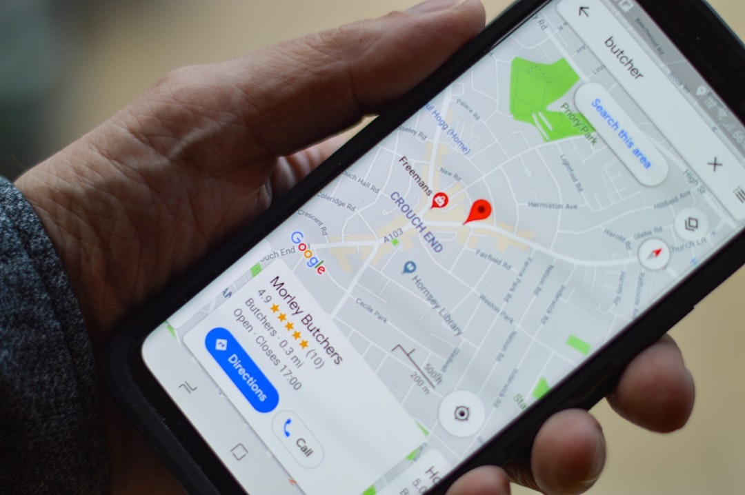
Peak summer driving is here. Rental car lines in Nice are an hour long, Montenegro’s coastal roads are jammed at 35°C, and U.S. national park entrances are backed up before 9 a.m. If you’re road-tripping in July 2026, Google Maps’ wider rollout of Immersive Navigation and the built-in speedometer in Android Auto could quietly make your trip smoother—and cheaper.
Key Takeaways
- Immersive Navigation is expanding globally in July 2026, offering 3D, lane-level previews in major cities and highways.
- Android Auto’s speedometer is now available to more vehicles, reducing the need for third-party speed apps.
- Immersive mode can use 15–25% more battery per hour than standard navigation—plan for charging on long drives.
- Works best on Android 14+ devices with 6GB+ RAM; Android Auto requires version 12.0+ and compatible car head units.
What Is Google Maps Immersive Navigation?
Immersive Navigation builds on Google’s 3D “Immersive View” and adds turn-by-turn overlays, realistic building models, lane guidance, and traffic animations in real time.
Instead of a flat map with arrows, you see a 3D preview of your route—bridges, tunnels, roundabouts, and even complex highway interchanges—before you reach them.
Why this matters when you’re traveling: In unfamiliar cities—think Palermo’s chaotic ring roads or Los Angeles’ five-lane freeway splits—visual clarity reduces wrong turns. Every missed exit in peak season can cost 15–30 minutes.
Compatibility (July 2026)
- Phones: Android 14 or newer recommended; works on Pixel 7+, Samsung Galaxy S23+, and similar devices with 6GB–12GB RAM.
- Storage impact: Google Maps app size ~350MB; immersive assets stream dynamically (minimal permanent storage use).
- Data usage: ~5–8MB per 10 minutes in immersive mode (about 30–50MB per hour).
- Battery drain: 15–25% per hour on a 4,500mAh phone screen-on at 70% brightness.
If you’re relying on eSIM data abroad, that 50MB/hour matters. On Airalo’s Europe regional plan ($39 for 10GB/30 days), an 8-hour drive could consume ~400MB—4% of your allowance.
Still cheaper than getting lost in toll roads around Milan.
Android Auto Speedometer: Small Feature, Big Travel Impact
The second part of the rollout is less flashy but arguably more useful: a native speedometer inside Android Auto.
Instead of relying solely on your car’s dashboard (which may be in km/h when you’re used to mph—or vice versa), Google Maps now shows your current speed and the posted limit directly on your infotainment screen.
Why this matters when you’re traveling: Rental cars are notorious for confusing dashboards. In France, speed cameras can fine you €68–€135 for minor overages. In parts of Argentina, roadside stops are common for speeding tourists.
A visible digital speed readout aligned with Maps’ limit data reduces that risk.
Requirements
- Android Auto: Version 12.0+
- Car support: Most 2018+ vehicles with Android Auto (wired or wireless)
- Wireless AA: Best with cars from 2021 onward; otherwise expect wired USB-C
If your rental lacks Android Auto, consider bringing a $129 Motorola MA1 wireless Android Auto adapter (68g). It works in most USB-A equipped cars and saves you from cable clutter.
Traveler verdict: If you drive abroad more than once a year, Android Auto support is now a non-negotiable rental filter.
Real-World Test: Mediterranean Summer Drive
I tested Immersive Navigation on a 220km coastal drive in Montenegro in July—yes, the same region we covered in our breakdown of cheap Montenegro weekend trips and 35°C heat in Kotor.
Here’s what stood out:
1. Roundabouts Were Clearer
Balkan roundabouts can have 5–6 exits with minimal signage. Immersive preview showed the exact lane positioning 300–500 meters ahead.
I missed zero exits. On standard 2D Maps, I usually miss one.
2. Mountain Roads Felt Less Stressful
In Durmitor National Park, elevation shifts and sharp bends are common. The 3D terrain modeling helped anticipate curves.
It doesn’t replace caution—but it reduces “blind panic turns.”
3. Battery Drain Is Real
On a Pixel 8 (4,575mAh battery), I dropped from 92% to 61% over 2 hours with screen always on. That’s ~15% per hour.
Plug into the car. Always.
Where Immersive Navigation Makes the Biggest Difference
Not every destination benefits equally.
High impact locations:
- Large interchanges (Los Angeles, Paris périphérique, Tokyo expressways)
- Dense old towns with one-way streets (Lisbon, Naples, Buenos Aires)
- Airport drop-off zones during peak season
- Tour de France route detours (July traffic chaos is real)
Lower impact locations:
- Rural highways in Peru or Bolivia (dry season road trips are straightforward)
- Straight desert roads in northern Chile
- Grid cities with simple layouts
In places like Buenos Aires—where we’ve detailed how to optimize your daily budget down to $25 for food—efficient navigation saves taxi costs and time. See our guide to eating intentionally in Buenos Aires on $25 a day for context on how small savings compound.
Immersive Navigation vs Apple Maps 3D
If you’re deciding between ecosystems, here’s the honest breakdown.
Apple Maps 3D
- Works best on iPhone 13+ with A15 chip or newer
- Extremely smooth city rendering
- Limited city coverage outside North America and Western Europe
Google Maps Immersive
- Broader global data
- Stronger integration with Android Auto
- Higher battery usage
Buy Android if: You road trip internationally often and rely on rental cars with Android Auto.
Stick with iPhone if: You mainly travel within major Western cities and value tighter hardware optimization.
Data & Connectivity: What Travelers Should Budget
Navigation abroad is only as good as your connection.
Here’s what to plan for an 8-hour road trip using Immersive mode:
- Data usage: 300–400MB
- Battery: 60–80% total drain without charging
- Car charger: 20W USB-C minimum recommended
If you’re doing a long-haul summer escape to South America (currently some of the cheapest July–August fares of the year), preload offline maps before departure.
- Open Google Maps
- Tap profile → Offline maps
- Select custom area
- Download over Wi-Fi
Offline maps don’t support full immersive detail, but they prevent total failure in weak coverage zones.
Safety & Legal Considerations
Speed limit indicators in Google Maps are not legally guaranteed. They rely on mapping data and user reports.
Why this matters when you’re traveling: In countries like Italy or Spain, speed cameras are automated. A €90 ticket arriving months later ruins the memory of your wild swimming detour.
Use the speedometer as guidance—not gospel.
Should You Upgrade Your Phone for This?
If you’re on a 2019–2021 midrange Android with 4GB RAM, Immersive Navigation may feel laggy.
Recommended 2026 travel-ready Android phones:
- Google Pixel 9: $699, 4,700mAh battery, 24-hour mixed use, 187g
- Samsung Galaxy S25: $799, 4,900mAh battery, 29-hour video playback, 195g
- Nothing Phone (3): $599, 5,000mAh battery, 190g
Traveler verdict: If navigation is mission-critical for your trips, 6GB RAM is the bare minimum in 2026. 8GB+ is safer.
When to Skip Immersive Mode
There are moments when simpler is better.
- Low battery and no charger
- Weak rural data coverage
- Short city walks where 3D adds little value
Switch back to standard mode to save power.
The Bigger Picture: Why This Rollout Is Timed Well
July is peak driving chaos across Europe and North America. Families are on the road. Tour routes are congested. Airports are overwhelmed.
At the same time, contrarian travelers are heading to monsoon Southeast Asia (cheaper hotels, fewer crowds) or dry-season Peru and Bolivia for high-altitude road trips.
Better navigation tools matter most when conditions are unpredictable.
Google widening access now suggests they see summer road travel as a key use case—not just urban sightseeing.
Final Take: Is Immersive Navigation Worth Using?
Yes—with caveats.
If you’re navigating complex highways, foreign road rules, or dense historic centers, Immersive Navigation reduces stress and wrong turns.
If you’re cruising straight rural highways with patchy data, standard mode plus offline maps is enough.
The Android Auto speedometer is the real sleeper hit. It’s simple, practical, and could save you more money in fines than any other feature.
Bottom line for travelers in July 2026: Turn it on for big-city driving, keep a charger plugged in, download offline backups, and always verify speed limits with real signage.
Frequently Asked Questions
Is Google Maps Immersive Navigation available worldwide?
It’s expanding globally as of July 2026, but full 3D detail is strongest in major cities and highways. Rural areas may default to standard navigation.
How much data does Immersive Navigation use?
Expect roughly 30–50MB per hour of active use. An 8-hour road trip can consume around 300–400MB of mobile data.
Does Android Auto now show speed limits and your current speed?
Yes, on Android Auto 12.0+ with supported vehicles. It displays your current speed and the posted limit, but always confirm with road signs.
Will Immersive Navigation drain my battery faster?
Yes. On a 4,500–5,000mAh phone, expect 15–25% battery drain per hour with the screen on. Use a 20W car charger for long drives.

About the Author: Tomáš Bzirský
Founder and editor of Distratech. Based in the Czech Republic, travelling regularly from Central Europe. Writes practical travel guides and travel-tech comparisons (eSIM, apps, airports) in six languages.