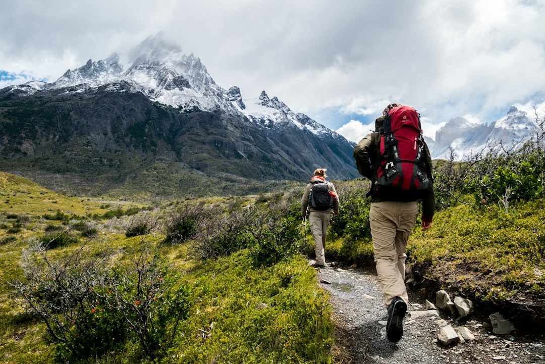
A hiker types “best 4-hour loop near Tenerife’s Teide, moderate difficulty” into ChatGPT, gets a confident itinerary with trail names, distances and a finish time, and sets off at 1pm in trainers with a half-charged phone. By 5:40pm the sun is down, the “moderate” route has become a scramble over volcanic scree, and the trail name the chatbot invented doesn’t exist on any map. Search and rescue teams from British Columbia to the Alps to the Scottish Highlands now report versions of this story every month.
November is peak season for exactly this kind of trip: winter-sun hiking in the Canaries, Madeira and Oman, aurora hunting in Iceland and Norway, cheap off-season trekking in Europe. It’s also the month people buy new tech on Black Friday. So this is the moment to be blunt about what a chatbot can and cannot do when you’re on a ridge with no signal, and what to carry instead.
Key Takeaways
- Large language models (ChatGPT, Gemini, Claude, Perplexity) have no GPS, no terrain model and no live weather or closure feed — they generate plausible text, not verified routes.
- A dedicated offline map app costs $0–40 a year (Organic Maps free, AllTrails+ $35.99, Gaia GPS Premium $39.99) and does the one thing a chatbot can’t: show where you actually are.
- A satellite messenger like the Garmin inReach Mini 2 (100 g, $399.99, 14 days of battery) or Zoleo (150 g, $199.99) turns a bad decision into a message home instead of a headline.
- Use AI for brainstorming and packing lists, then verify every trail, distance and sunset time in a map app and on the park authority’s site before you commit.
- Black Friday 2026 (27 November) is the right time to buy a satellite messenger or GPS watch — expect 20–30% off — and the wrong time to buy an “AI hiking planner” subscription.
What’s Actually Happening on the Trail
Rescue coordinators in Canada, the UK, Italy and the US have started asking a new question when they debrief rescued hikers: “How did you plan this?” A growing share of answers now include “I asked ChatGPT” or “Gemini said it was a four-hour walk.”
The pattern is consistent. The hiker gets a fluent plan with specific numbers — “12.4 km, 580 m of elevation gain, 3.5 hours” — that creates a false sense of precision. Then one of three things goes wrong: the trail name was hallucinated or belongs to a different mountain; the difficulty rating came from a summer description and the route is now iced over or washed out; or the time estimate assumed a fit local, not a jet-lagged traveler who landed in Funchal that morning.
Why this matters when you’re traveling: at home you’d spot a wrong trail name in seconds. Abroad, with signage in a language you don’t read, the chatbot’s confidence is the only reference point you have — exactly when you need the most verifiable tool, not the most confident one.
Why Chatbots Get Hiking Wrong
This isn’t a “don’t trust AI” rant. I use Claude and ChatGPT daily for packing lists, translating trailhead signs and drafting messages to guesthouses. But navigation and risk assessment are where the technology’s structural weaknesses line up with the ways people get hurt outdoors.
- No position awareness. A language model can’t say “you missed the turn 200 m back.” A free app like Organic Maps can.
- No live data by default. Trail closures, rockfall warnings, avalanche bulletins and Madeira levada maintenance notices live on park sites updated weekly. Most chatbot answers come from training data a year or more old.
- Invented specifics. Ask for a “loop” where none exists and you’ll often get one anyway, stitched from two real trails that don’t connect.
- No terrain or season model. “Moderate” is an averaged adjective, not a slope angle. Komoot and Gaia compute grade from real elevation data, and a 3.5-hour summer hike on Madeira’s Pico do Arieiro–Pico Ruivo route is a different animal in November fog with 10 hours of daylight.
- Weather is a guess. Teide’s summit can be 15°C colder than the coast; Oman’s wadis flash-flood after November rain in the Hajar mountains. Unless the model is actively browsing, it has no forecast.
- Outsourced judgement. Once the plan is “done,” people stop asking the questions they’d normally ask: where’s the escape route, what’s my turnaround time, who knows where I am.
Every one of these failure modes gets worse far from home, on a foreign eSIM with patchy coverage, racing a sunset you haven’t looked up.
Chatbot vs the Tools Built for the Job
Here’s how the options compare for a traveler planning a day hike abroad. Prices are what you’ll pay in November 2026.
| Tool | Price (Nov 2026) | Works offline? | Shows your live position? | Live closure data? | Emergency SOS? | Traveler verdict |
|---|---|---|---|---|---|---|
| ChatGPT Plus / Gemini Advanced / Claude Pro | $20/month | No | No | Only if browsing and lucky | No | Brainstorm and packing lists only |
| Organic Maps | Free | Yes (download by region) | Yes | No | No | Install before every trip |
| AllTrails+ | $35.99/year | Yes | Yes, plus off-route alerts | User reports, often days old | No | Best for popular trails in Europe/US |
| Gaia GPS Premium | $39.99/year | Yes | Yes | Weather, snow and land layers | No | Best for off-trail or alpine |
| Komoot Premium | €59.99/year (regions from €3.99) | Yes | Yes | Official closures in DE/AT/CH | No | Best for Alps and Central Europe |
| Garmin inReach Mini 2 | $399.99 + plan from $14.99/month | Yes | Yes (basic) | Satellite weather forecasts | Yes, two-way | Buy if you hike alone or beyond signal |
| iPhone / Pixel satellite SOS | Free (iPhone 14+, Pixel 9+) | Partially | Yes | No | Yes, limited countries | Backup, not primary |
The gap is obvious. The $20-a-month tool is the only one on the list that can’t tell you where you are, and it’s the one people increasingly use as their primary planner. Keep chatbots in their lane: converting units, explaining what a Spanish “sendero cerrado” sign means, drafting a message to a Madeiran taxi driver about a 7am trailhead pickup.
Satellite Messengers Compared
The fix for “the chatbot sent me the wrong way” isn’t a better chatbot. It’s a device that works when the plan fails. For November trips to the Canaries, Madeira, Oman, Sri Lanka’s Knuckles Range or an Icelandic aurora site, that means a satellite messenger.
| Device | Weight | Price (Nov 2026) | Battery | Subscription | Traveler verdict |
|---|---|---|---|---|---|
| Garmin inReach Mini 2 | 100 g | $399.99 / €399.99 | 14 days (10-min tracking), 30 days (30-min) | From $14.99/month, pauses between trips | Best overall for solo travelers |
| Garmin inReach Messenger Plus | 122 g | $499.99 / €499.99 | Up to 25 days | From $14.99/month | Buy if you want to send photos home from the trail |
| Zoleo | 150 g | $199.99 / €229 | 200+ hours | From $20/month, 3-month minimum | Buy if budget matters more than weight |
| Apple Watch Ultra 3 | 61.6 g | $799 / €899 | 42 hours (72 low power) | Free for 2 years | Buy if you already wanted a GPS watch |
| iPhone 17 satellite features | 177 g | From $799 | One day with GPS | Free for 2 years | Backup only — a phone is your map, not your lifeline |
Why I’d buy the inReach Mini 2 over the Zoleo despite the $200 gap: it’s 50 g lighter, works without your phone, and the plan pauses between trips. If you hike twice a year, you’ll spend roughly $60 on plans annually rather than $240 on Zoleo’s minimum term.
Why I wouldn’t rely on phone satellite SOS alone: it needs a charged phone, a clear view of the sky and a supported country. Sri Lanka, Oman and Cape Verde were not on Apple’s list as of November 2026. The Canaries and Madeira are covered under Spain and Portugal, but a phone at 8% in cold wind is still a phone at 8% — and at 0°C with GPS tracking, expect only 4–7 hours of battery.
Offline Map Apps: Which One for Which Trip
Download the region before you leave hotel Wi-Fi — Madeira on Organic Maps is about 80 MB, the entire Canary Islands around 120 MB — then test it in airplane mode.
- Canaries and Madeira: AllTrails+ has the deepest library of user-recorded routes, and off-route alerts earn their keep on the levada network where side channels look identical. Pair with the official Teide National Park site for closures.
- Alps and Central Europe: Komoot understands via ferrata and hut-to-hut logic, and the German and Austrian alpine clubs push closure data into it. Mapy.cz (free) is the sleeper pick for Czech, Slovak and Polish mountains.
- Oman and Sri Lanka: Gaia GPS or Organic Maps. Crowd-sourced trail data is thin, so you want topographic layers and the ability to import a GPX file from a local guide.
- Iceland and Norway aurora trips: Organic Maps plus safetravel.is or ut.no. Most aurora “hikes” are short walks from a car, but darkness arrives by 16:30 and winds change fast.
- Thailand jungle: Khao Sok’s trails are mostly guided, which is the right call. If you’re building a family winter-sun itinerary, our 28-night Thailand plan for families under the new 30-day visa-free rules covers how to fit Khao Lak and Khao Sok in without overcommitting the kids.
Data note: you’ll want a local eSIM for downloading maps, checking the forecast and messaging guesthouses. A 5 GB regional Europe plan from Airalo runs about $20 in November 2026 — enough for the maps, not enough to stream your evening. That’s fine; the maps are the point.
How to Use AI for Hike Planning Without Getting Hurt
You don’t have to throw the chatbot away. Put it first in your workflow, never last.
- Brainstorm with AI, then stop. Ask for five hike ideas near your base. Treat every trail name as a lead to verify, not a fact.
- Verify the trail exists in a map app. Search it in AllTrails, Komoot or Organic Maps. If it isn’t there, it may be invented. If it is, note the real distance and elevation.
- Check the official source for closures. Teide National Park, Visit Madeira’s levada status page, safetravel.is, Oman’s Ministry of Heritage and Tourism. Five minutes catches the most common failure.
- Look up sunset yourself. Mid-November sunset is about 18:10 in Tenerife, 17:45 in Funchal, 17:25 in Muscat and 16:30 in Reykjavík. Set a turnaround time at least two hours before that.
- Tell a human your plan. Guesthouse owner, travel partner, family group chat — route, turnaround time and check-in time.
- Carry a power bank and, if solo, a satellite messenger. A 10,000 mAh Anker Nano (215 g, about $25) gives roughly two full phone charges.
- Re-ask the chatbot only for non-navigation help. “How do I say ‘I need a taxi at the trailhead’ in Portuguese?” is a great use. “Is this path safe?” is not.
Abroad, the chatbot’s polish makes it tempting to skip the checks you’d do automatically at home. A fixed checklist removes the temptation.

Common Mistakes Travelers Make With AI Trail Plans
- Trusting a time estimate that ignores daylight. The single most common November rescue scenario: a 4-hour hike started at 14:00 ends in the dark almost everywhere in the northern hemisphere.
- Using Google Maps walking directions for trails. It has sent hikers up unofficial tracks on Teide and Ben Nevis for years. The chatbot problem is the same issue with a friendlier interface.
- Wearing what the chatbot suggested. Models routinely recommend “comfortable shoes” for routes that need ankle support. Trainers on wet levada stone or Icelandic basalt are a sprained ankle waiting to happen.
- Assuming phone satellite SOS covers every country. It doesn’t, and the list changes. Check Apple’s or Google’s support page the week before you fly.
- Letting the plan replace judgement. If the trail looks wrong, it’s wrong. Your own eyes outrank the chatbot.
Black Friday 2026: What’s Worth Buying for Winter Hiking
Black Friday lands on 27 November 2026, right in the middle of winter-sun and aurora season. Here’s where I’d spend and where I wouldn’t.
- Buy: Garmin inReach Mini 2. Dropped from $399.99 to $299.99 in 2024 and 2025; expect the same. At that price it’s the best safety purchase a solo traveler can make.
- Buy: a GPS watch with offline maps. Garmin Fenix 8 (from $999, usually $150–200 off), Apple Watch Ultra 3 ($799, expect $50–100 off), or the budget Garmin Instinct 3 (from $399). A map on your wrist beats pulling out a phone in wind.
- Buy: a 10,000 mAh power bank. Around $20 on sale. Cold kills phone batteries; this is the cheapest insurance in this article.
- Skip: “AI hiking planner” subscriptions. Several launched in 2025–2026 at $5–10/month. They wrap the same language models in a nicer interface and add nothing AllTrails plus five minutes of reading can’t.
- Skip: a ChatGPT Plus upgrade “for travel.” The free tier handles packing lists and translation. Spend the $20 on a year of Gaia GPS or a Komoot region bundle instead.
If you’re flying to the Canaries or Madeira in early December on a low-season fare, ordering a satellite messenger on Black Friday leaves just enough time to activate and test it before departure. Don’t leave activation for the airport.
The Bottom Line
Chatbots are excellent travel assistants and dangerous navigators. Their biggest strength — fluent, confident, complete-looking answers — is precisely what makes them unsafe for a task where the right answer is often “it depends, check the conditions, and turn back early.”
The fix costs less than a night in a Canarian hotel: a free offline map app, a $20 power bank and, if you hike alone, a $300 satellite messenger bought on Black Friday. Put the AI at the start of your planning, the map app in the middle and your own judgement at the end. Winter hiking in November is some of the best in the world — empty trails on La Palma, cool mornings in Oman’s wadis, dark skies in Iceland. Enjoy it with tech that knows where you are.
Frequently Asked Questions
Can I use ChatGPT to plan a hike?
Yes, for brainstorming, packing lists and translations — never as your final route source. Chatbots have no GPS, no live closure data and routinely invent trail names, so verify every suggestion in AllTrails, Komoot or Organic Maps and on the park’s official site.
What is the best offline hiking app for travelers?
Organic Maps (free) covers most marked trails worldwide and works fully offline. AllTrails+ ($35.99/year) is best for the Canaries, Madeira and the US, while Komoot (€59.99/year Premium, or regions from €3.99) is stronger in the Alps and Central Europe.
Is a satellite messenger worth it for a one-week hiking holiday?
If you hike alone or beyond mobile coverage, yes. A Garmin inReach Mini 2 weighs 100 g, lasts 14 days per charge and costs $399.99 (often $299.99 on Black Friday) plus a plan from $14.99/month that you can pause between trips.
Does iPhone Emergency SOS via satellite work in the Canary Islands and Madeira?
Yes, as of November 2026 both are covered under Spain and Portugal, free for two years with an iPhone 14 or later. It isn’t available in Oman, Sri Lanka or Cape Verde, and it needs a charged phone with a clear view of the sky.
How long does a phone battery last while hiking with GPS in cold weather?
Expect 4–7 hours of continuous GPS tracking at around 0°C, versus 8–12 hours in warm conditions. A 10,000 mAh power bank (about 215 g, $20–25) adds roughly two full charges.

About the Author: Tomáš Bzirský
Founder and editor of Distratech. Based in the Czech Republic, travelling regularly from Central Europe. Writes practical travel guides and travel-tech comparisons (eSIM, apps, airports) in six languages.